
THE FUTURE OF FARMING
Our Mission
At ALAND AI Drones our mission is to revolutionise modern agriculture through precision drone technology.
We are committed to delivering innovative aerial spraying, seeding, and mapping solutions that enhance productivity, reduce environmental impact, and empower growers with data-driven insights
Our team are fully CASA certified and operate in compliance with all Australian aviation regulations. Partnered with qualified agronomists to ensure every operation is accurate, effective, and aligned with best-practice agronomic outcomes, delivering reliable results for our clients.
Discover our services
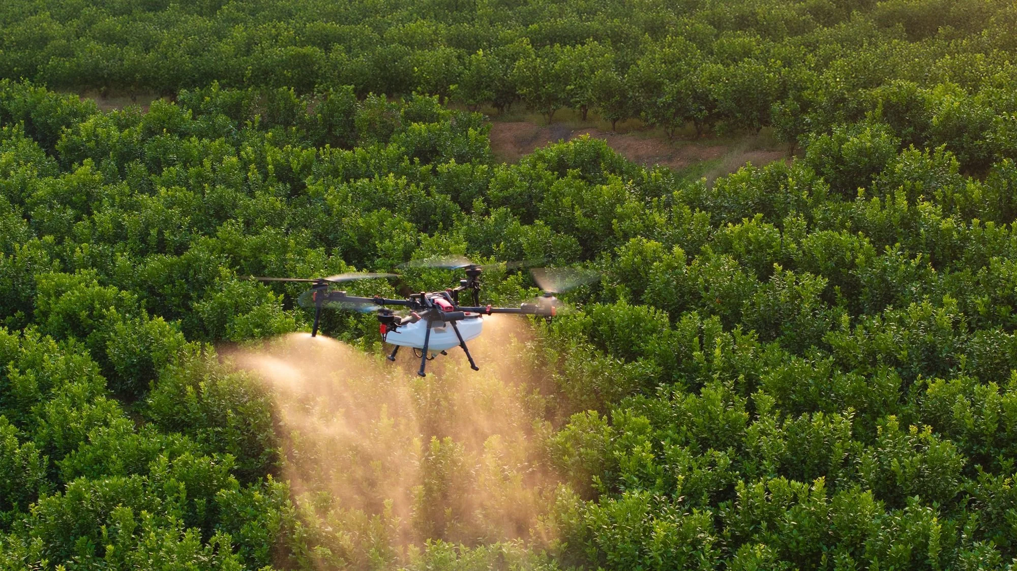
We offer professional drone services including spraying, seeding, spreading, and mapping.
Get a fast, free, no-obligation quote tailored to your property and requirements.
Fill out the form attached and we’ll get back to you within 24 hours.
Efficient, uniform application of herbicides, pesticides, and fertilisers. Our drones ensure accurate coverage, reduced chemical use, and improved crop health across all types of terrain. Plus, if we supply the chemical, you get warranty.
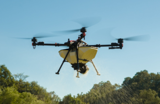
Fast, precise aerial seeding for even crop establishment. Ideal for large-scale farms or hard-to-access areas, ensuring consistency and reduced labour.
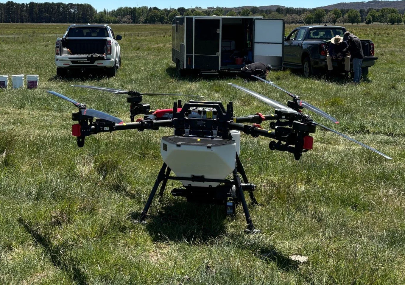
<25kg Initial Multirotor RePL. Theory and practical flying for the issue of an initial remote pilot licence. Course includes an AROC.
Remote Pilot Licence (RePL) training course is designed to equip you with the knowledge and practical skills required to operate drones safely and legally for commercial purposes.
Delivered by experienced instructors, the course ensures you meet all Civil Aviation Safety Authority (CASA) requirements for certification. Upon successful completion, you’ll be qualified to apply for your RePL and begin conducting professional drone operations across a wide range of industries, including aerial photography, surveying, construction, and inspections.
The course covers such topics as:
Theory Modules:
Aviation regulations (CASA rules & legal requirements)
Airspace structure and classifications
Aeronautical charts & navigation basics
Meteorology (weather and its effects on flight)
Human factors (fatigue, decision-making, safety)
Drone systems & components
Risk management and operational planning
Practical Training:
Pre-flight planning and site assessment
Safe drone operation and flight manoeuvres
Take-off, landing, and in-flight control
Emergency procedures and fault management
Real-world flight scenarios and assessments
Aeronautical Radio Operator Certificate (AROC) – Course Content
The AROC course focuses on safe and correct use of aviation radio communications.
Course Covers:
Radio theory and communication basics
Aviation phraseology and standard terminology
Radio procedures for controlled and uncontrolled airspace
Communicating with air traffic control (ATC)
Situational awareness and traffic coordination
Practical radio call scenarios and assessments
OUR PRODUCTS
Overview
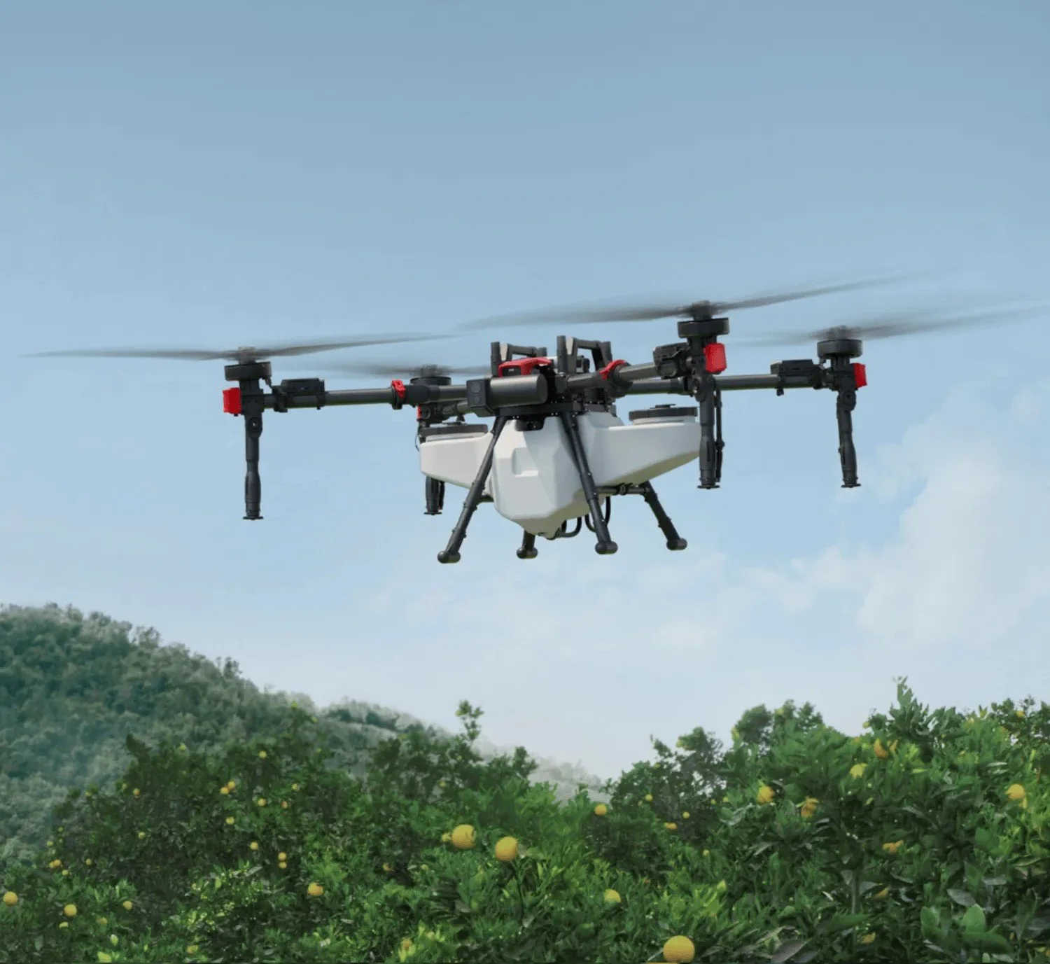
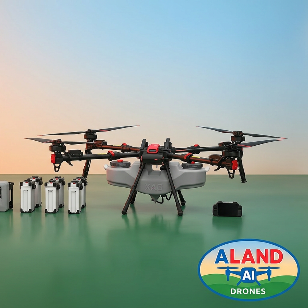
The XAG P150 Max is a high-performance agricultural drone designed for precision farming, efficient crop spraying, and large-scale field operations. Built with advanced automation, powerful payload capacity, and intelligent control systems, it delivers reliable performance for modern agricultural needs.
Package Includes
1 × XAG P150 Max Drone
1 × XAG RevoSpray P5 System
1 × SRC5 Remote Controller
4 × Smart Batteries
4 × Battery Chargers
2 × Parallel Charging Kits
2 × XAG Mist Cooling Charger Tanks
Key Features
High-Capacity Agricultural Drone
Designed for large-scale farming operations
Heavy payload capability for efficient spraying
Durable construction for demanding environments
RevoSpray P5 System
Precision spraying technology
Uniform droplet distribution
Optimized for crop protection and fertilization
SRC5 Remote Controller
Advanced flight control system
User-friendly interface
Real-time monitoring and operation control
Smart Battery System
High-capacity, long-lasting batteries
Quick-swap design for minimal downtime
Intelligent battery management for safety and efficiency
Advanced Charging Setup
4 battery chargers for flexible charging options
2 parallel charging kits for faster multi-battery charging
Mist cooling tanks for temperature control and battery protection
Applications
Crop spraying (pesticides, herbicides, fertilizers)
Precision agriculture
Large-scale farm management
Orchard and field operations
Benefits
Increased operational efficiency
Reduced labor costs
Consistent and accurate spraying
Scalable for commercial farming
Why Choose the XAG P150 Max?
This alternative package configuration is optimized for operations that require more flexible and efficient charging workflows. With parallel charging capability and multiple chargers, it helps maximize uptime and keep your drone working longer in the field.
Contact / Purchase
For pricing, availability, and customization options, please contact us or give Todd a call on 0494 003 010.

Overview
The XAG P150 Max is a high-performance agricultural drone designed for precision farming, efficient crop spraying, and large-scale field operations. Built with advanced automation, powerful payload capacity, and intelligent control systems, it delivers reliable performance for modern agricultural needs.
Package Includes
1 × XAG P150 Max Drone
1 × XAG RevoSpray P5 System
1 × SRC5 Remote Controller
6 × Smart Batteries
2 × Battery Chargers
2 × XAG Mist Cooling Charger Tanks
Key Features
High-Capacity Agricultural Drone
Designed for large-scale farming operations
Heavy payload capability for efficient spraying
Durable construction for demanding environments
RevoSpray P5 System
Precision spraying technology
Uniform droplet distribution
Optimized for crop protection and fertilization
SRC5 Remote Controller
Advanced flight control system
User-friendly interface
Real-time monitoring and operation control
Smart Battery System
High-capacity, long-lasting batteries
Quick-swap design for minimal downtime
Intelligent battery management for safety and efficiency
Charging & Cooling System
Dual battery chargers for faster turnaround
Mist cooling charger tanks for temperature control
Ensures optimal battery performance and longevity
Applications
Crop spraying (pesticides, herbicides, fertilizers)
Precision agriculture
Large-scale farm management
Orchard and field operations
Benefits
Increased operational efficiency
Reduced labor costs
Consistent and accurate spraying
Scalable for commercial farming
Why Choose the XAG P150 Max?
The XAG P150 Max Basic Package provides everything needed to get started with professional agricultural drone operations. With its powerful spraying system, reliable battery setup, and advanced control technology, it offers a complete, ready-to-deploy solution for modern farming.
Contact / Purchase
For pricing, availability, and customization options, please enquire below or give Todd a call on 0494 003 010.
SERVICE AREA
We support hobby farms, lifestyle blocks, orchards, vineyards, and broadacre operations in the following areas
Canberra:
Canberra, Queanbeyan, Bungendore, Murrumbateman, Yass, Royalla, Wamboin, Bywong, Captains Flat, Sutton, and surrounding localities
Riverina Region:
Wagga Wagga, Coolamon, Junee, Lockhart, Temora
South Coast:
Batemans Bay, Moruya, Ulladulla, Bega Valley, Narooma, Bermagui, Milton, Berry, Nowra, Jervis Bay, and nearby coastal communities.
Southern Tablelands:
Goulburn, Crookwell, Taralga, Marulan, Braidwood, Tarago, Collector, Bungonia, and surrounding districts
High Country Region:
Cooma, Jindabyne, Adaminaby, Tumbarumba, Tumut, Khancoban, Thredbo, Perisher region, and Snowy Mountains high-country farms
About Us
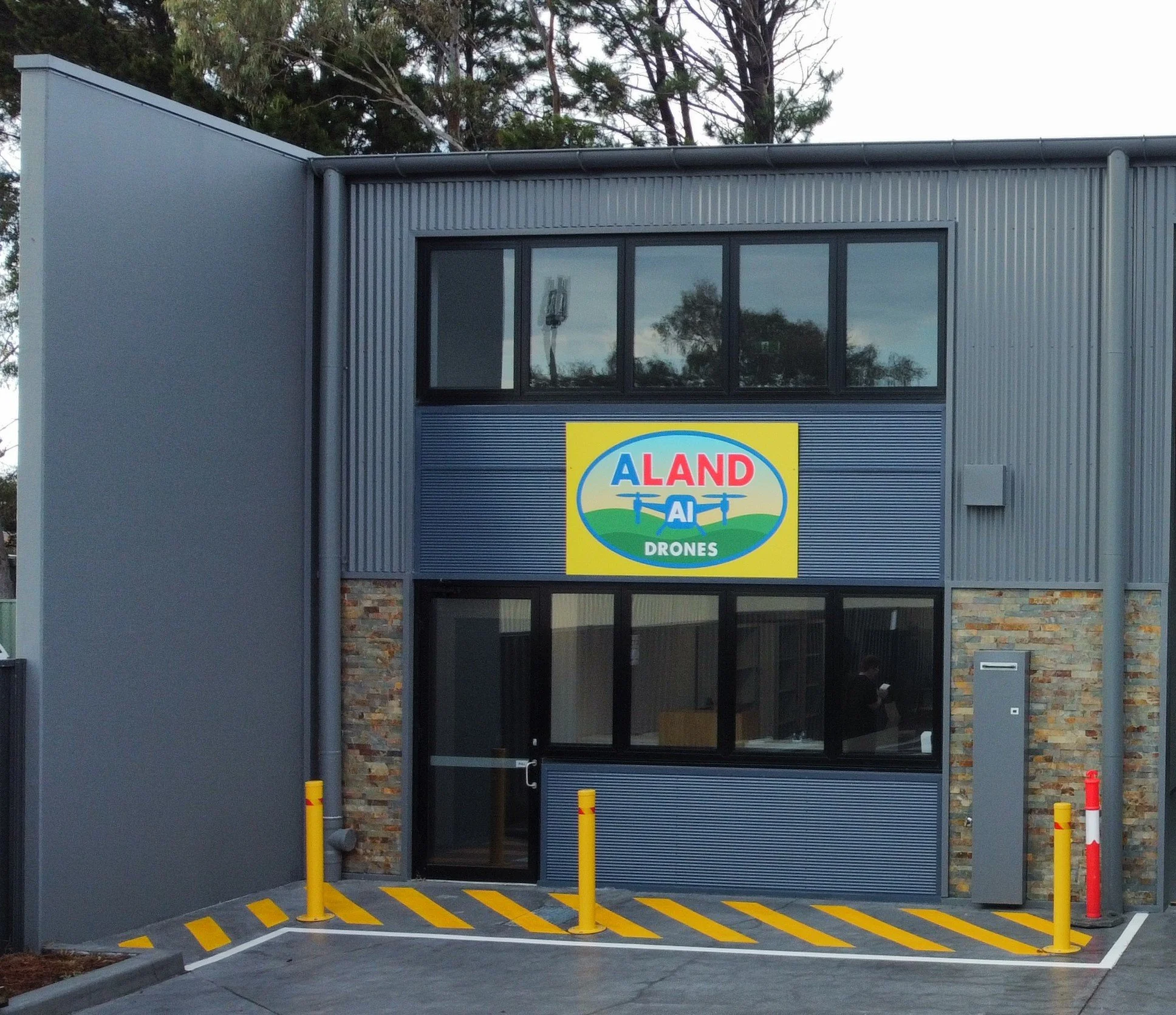
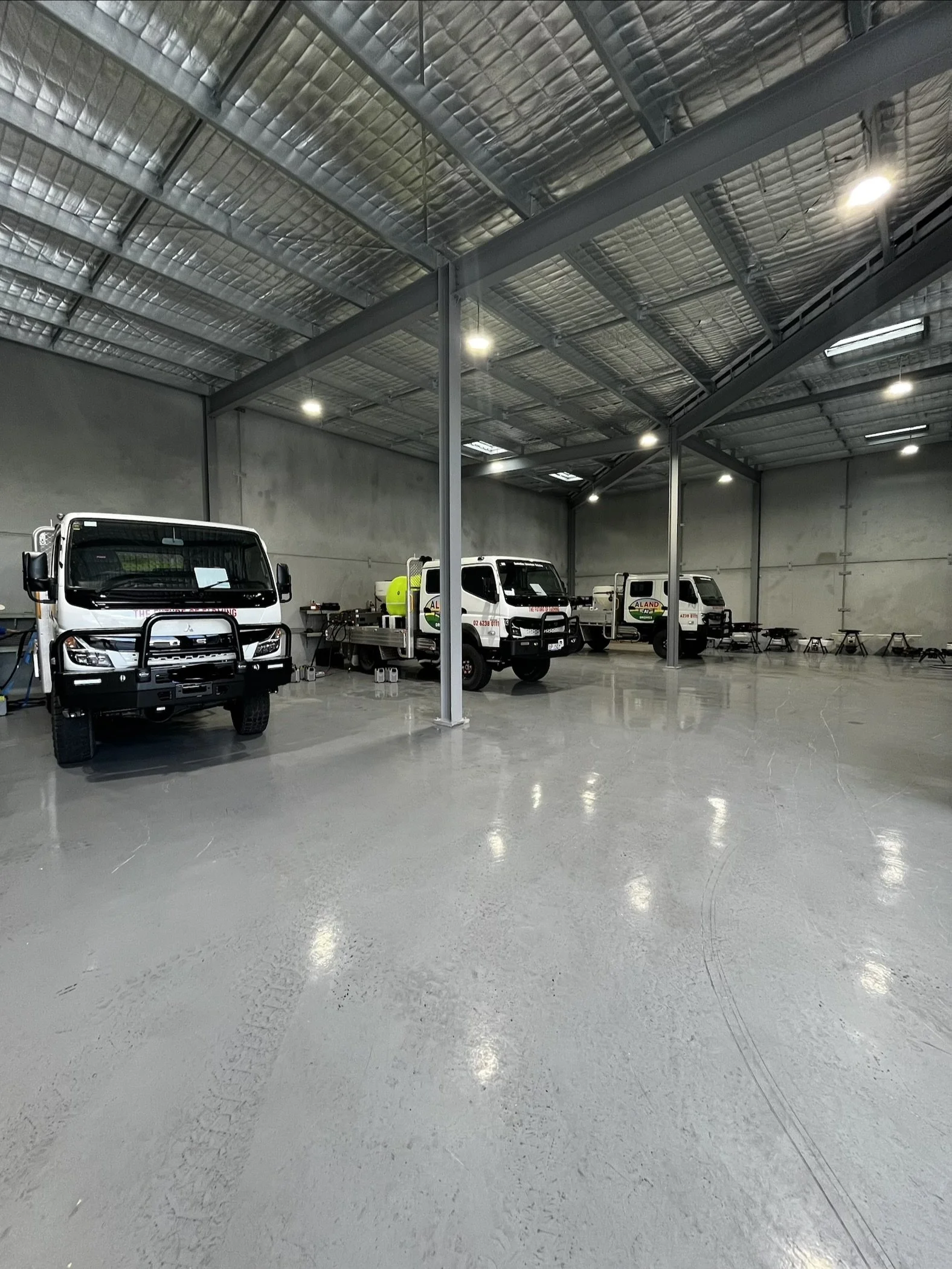
Aland AI Drones is a young, fast-growing agricultural technology company delivering industry-leading spraying, seeding, mapping, and agricultural data solutions across regional New South Wales and beyond. Built on innovation, reliability, and real boots-on-the-ground experience, we provide farmers with smarter, safer, and more efficient ways to manage their land.
Our team specialises in drone-based spraying operations, precision mapping, crop health monitoring, and aerial seeding, using advanced UAV platforms and AI-driven analytics to optimise productivity on every job. Whether it's large-scale broadacre work or targeted block-specific treatments, we deliver accurate results with minimal downtime and maximum efficiency.
Beyond field operations, Aland AI Drones is committed to supporting the next generation of operators. We offer comprehensive training, certification guidance, and end-to-end drone sales, helping individuals and businesses enter the rapidly expanding agricultural drone industry with confidence.
We pride ourselves on being agile, approachable, and deeply connected to the land we service. Every project—no matter the size—receives our full attention, backed by technical expertise, transparency, and genuine passion for agricultural improvement.
Contact Us
Give Todd a call on 0494 003 010
or fill out the form below.